|
 |
 |
|
 |
|
 |
|
|
|
Scientific files |
|
|
| |
 |
Nice area earthquake on February 25, 2001 |
MEMORANDUM FROM THE LABORATORY FOR DETECTION AND GEOPHYSICS (LDG)
 Earthquake overview Earthquake overview
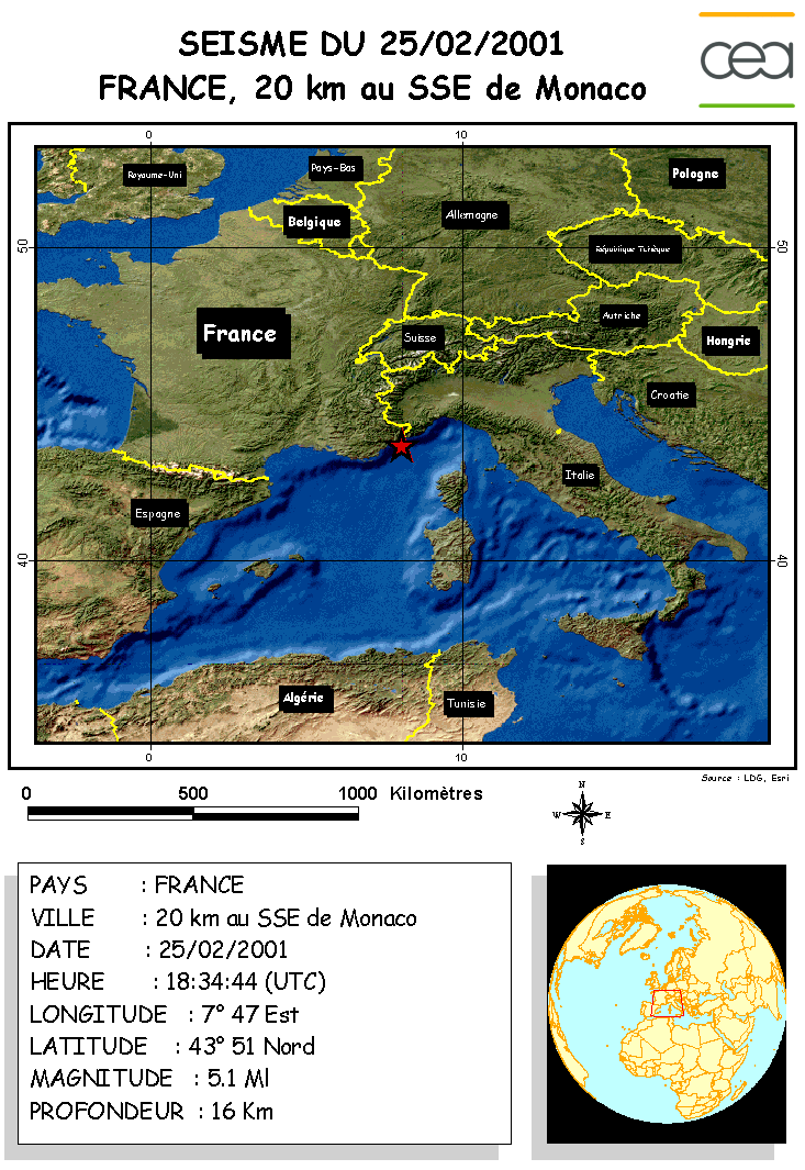
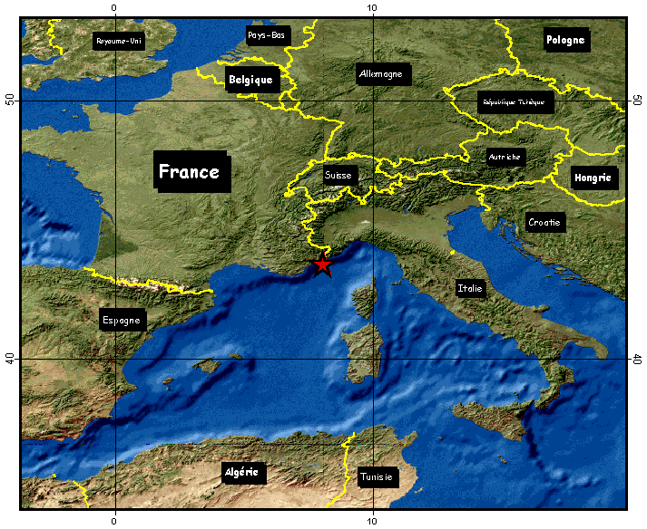
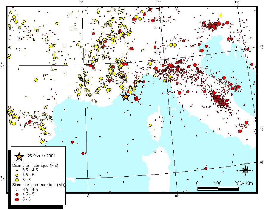
An earthquake of magnitude ML=5.1 occurred on February 25, 2001 at 6:34 pm UT (i.e. 7:34 pm in France). It occurred near the Mediterranean coast, 26 kilometers south-east of Nice (refer to Figure 1). This intermediate-depth earthquake was felt from Marseille to Genoa. Although the local residents were shaken by the event, no casualty or damage was reported at 1 pm on 26/02/2001.
 |
Map of earthquake location |
This earthquake triggered an LDG alert, and its semi-automatic result was sent out to the French civil security service by the duty seismologist one hour after the earthquake. Earthquake characteristics were as follows:
| ORIGIN TIME |
6:34:45 pm |
| LATITUDE |
43.5 North |
| LONGITUDE |
7.3 East |
| PROFONDEUR |
10 km |
| MAGNITUDE |
ML = 4.9 (LDG) |
|
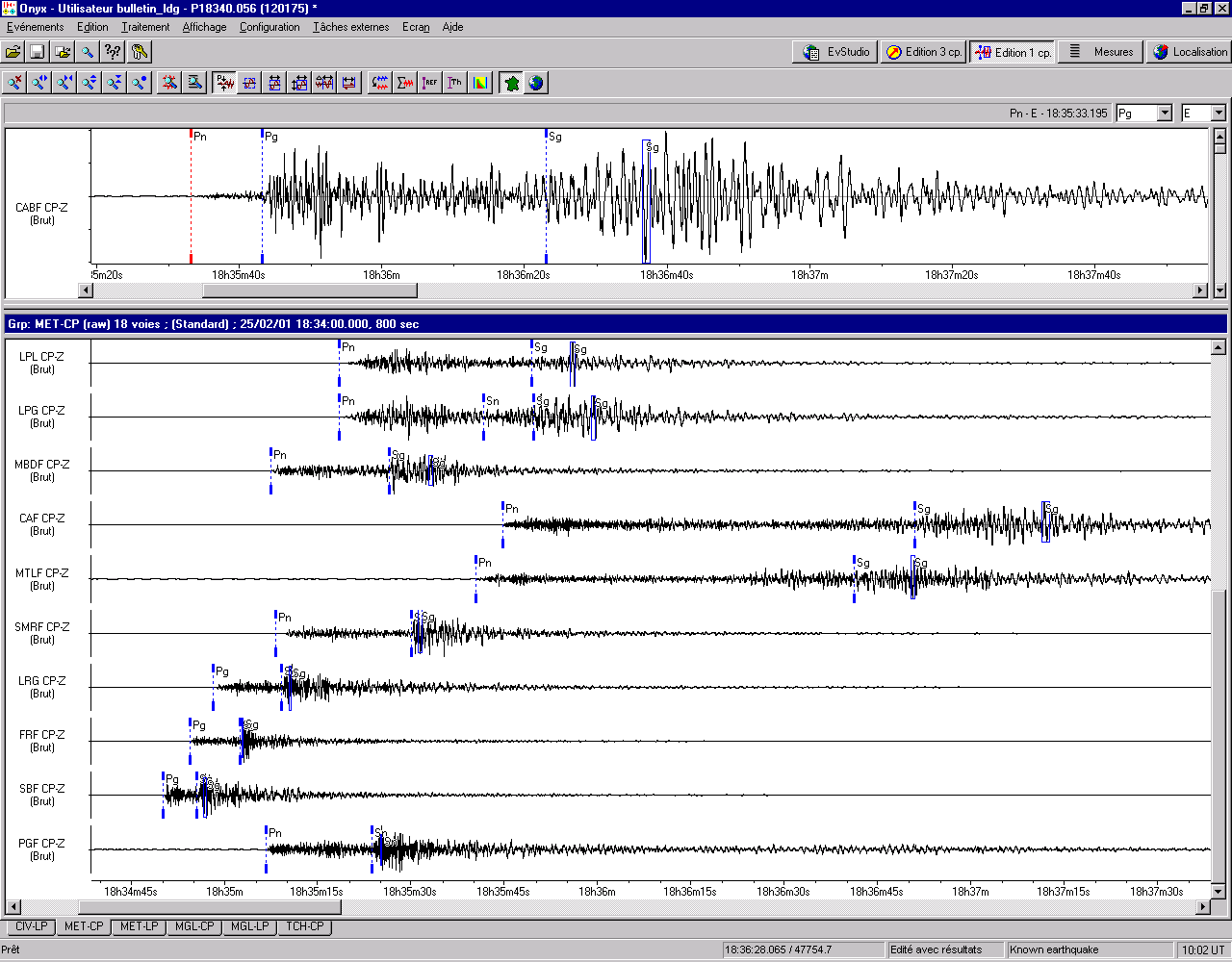
The earthquake was relocated, based on data from CEA-DASE/LDG (refer to the following Figure), a few network stations situated inland from Nice (RéNass) and one Italian seismic network station (DOI). The event was recorded by very distant seismic stations, e.g. the ALFM station in Mongolia. The gap (epicentral area coverage) is unsatisfactory as we only have one station south of the earthquake (PGF), which is situated in Corsica. Yet, the location's latitude and longitude can be estimated to within a few kilometers.
|
Recordings of the 25/02/2001 earthquake on the DASE network |
The characteristics of the relocated earthquake are as follows:
| ORIGIN TIME |
6:34:44 pm |
| LATITUDE |
43.51 North |
| LONGITUDE |
7.47 East |
| DEPTH |
16 km |
| MAGNITUDE |
ML = 5.1 (LDG)
Mb = 4.8
MS = 3.4 (ALFM) |
|
The main shock is followed by a few aftershocks of low magnitude, at 6:53 pm (ML = 2.2) and at 8:33 pm (ML = 2.4) on February 25. The focal depth, associated with the high magnitude, may explain why this event was felt throughout a large part of the Mediterranean coastline.
Characteristics of the main shock source
A detailed analysis of the recordings of this earthquake can be used to precisely determine the characteristics of the rupture which triggered the event. The spectral characteristics of the source were calculated from regional coda waves. The value of the scalar seismic moment can thus be assessed at 2.0 1016 N.m. The fault that ruptured during this earthquake is estimated to be about 2.5 km long. These values are perfectly normal for a seismic event of this magnitude range.
Characteristics of the main shock source
|
Previous seismicity in the area |
The coastal area is characterized by relatively active seismicity. The largest earthquake previously recorded occurred on April 21, 1995 (ML = 4.8). This earthquake, as well as numerous other recent earthquakes, was felt by the local residents. The chart below summarizes the activity of the last 30 years as far as events of a magnitude above 3.5 are concerned.
| Date |
Location |
Magnitude |
| September 8, 1974 |
43.58 N 7.29 E |
3.5 |
| September 14, 1974 |
43.37 N 7.99 E |
3.7 |
| March 16,1980 |
43.60 N 7.80 E |
3.5 |
| January 5, 1981 |
43.03 N 7.88 E |
3.6 |
| October 4, 1985 |
43.54 N 7.98 E |
4.0 |
| October 4, 1985 |
43.57 N 7.91 E |
3.7 |
| May 1, 1986 |
43.45 N 7.46 E |
3.8 |
| December 26, 1989 |
43.52 N 7.46 E |
4.5 |
| April 15, 1990 |
43.51 N 7.78 E |
4.2 |
| December 1, 1992 |
43.96 N 7.76 E |
3.5 |
| April 21, 1995 |
43.70 N 7.64 E |
4.8 |
| December 19, 2000 |
43.74 N 7.42 E |
3.7 |
| February 25, 2001 |
43.51 N 7.47 E |
5.1 |
|
Further south, the earthquake that occurred on July 19, 1963 (ML= 5.9) is the largest earthquake recorded in France. During the 19th century, two earthquakes with intensity* equal to or greater than VIII were documented and are probably linked to the same type of seismicity.
* Intensity should not be confused with magnitude. Intensity estimates the damage caused by an earthquake; magnitude represents a quantity that is intrinsic to the earthquake and related to released energy.
Characteristics of the main shock source
The Ligurian Sea is characterized by relatively high seismic activity (on the scale of France). This oceanic basin was formed during the Miocene period, about 10 million years ago, and it has now been under compression for a few million years. Caught between the North African and southern European margins that are converging at a rate of 5-7mm/year, the Corsican-Sardinian block is compressed between the Italian and Provençal margins. This structural geology also produced the active thrusts of the Tuscan Apennines.
|
Seismotectonic setting |
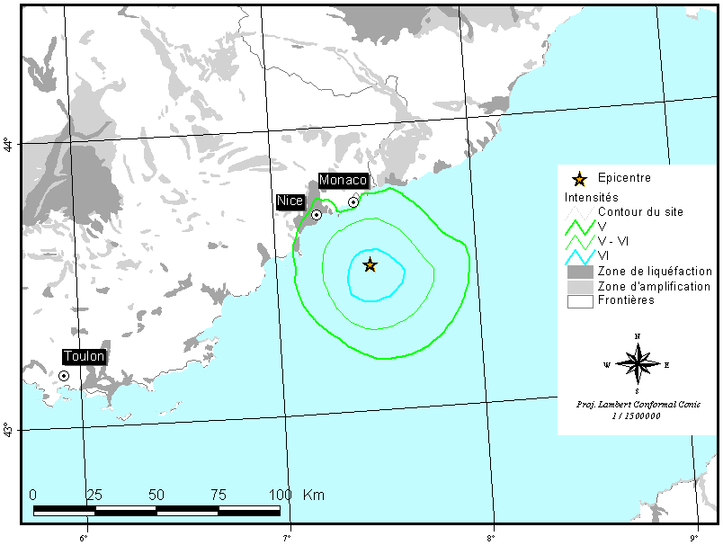
Macroseismic effect simulation
An effect simulation was carried out. It assumed an isotropic point source located at the hypocenter. Intensity is then calculated using attenuation laws which have been calibrated based on well-documented historical earthquakes throughout the mainland. Attenuation in the Ligurian Sea might be slightly different from the rest of the land, but historical data do not enable us to evaluate any possible difference. The simulation predicts earthquakes of intensity V (NB: intensity V definition: earthquake felt by everyone, awakens all sleepers, possible minor damage) near the coast. This simulation is compatible with the fact that the earthquake was largely felt in Provence.
|
Isoseismal map for the February 25, 2001 earthquake |
|
|
|