 |
 |
 |
 |
 |
 |
Scientific files |
 |
 |
| |

 |
Earthquake in southern Peru on June 23, 2001 |
 Contents Contents
 Earthquake overview Earthquake overview
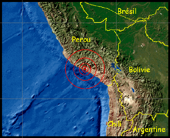
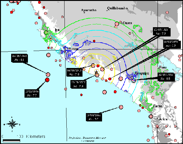
On 23/06/01 at 8:33:13 pm (UT), an earthquake of high magnitude (Mw: 8.2, depth: 20 km, source LDG) occurred in the Pacific subduction zone. This zone already experienced such events in 1868 with an 8.5 magnitude earthquake, and more recently in 1942 with an 8.1 magnitude earthquake.
The two focal mechanisms indicate a thrust fault roughly parallel to the subduction direction with a shallow north-eastward dip. Considering the context, an auxiliary plane with a steep westward dip is rather unlikely.

 |
Earthquake location map |
The isoseismal map shows maximum intensities of IX to X at the epicenter. An intensity of VII was recorded in Arequipa. A 2.50m high tsunami was recorded in Arica.

 |
Previous seismicity in the area and isoseismal map |
|
|
|