| |

 |
Analysis of the Algiers area earthquake May 21, 2003 |
MEMORANDUM FROM THE LABORATORY FOR DETECTION AND GEOPHYSICS (LDG)
 Kinematic source model of the 21/05/2003 Algiers earthquake Kinematic source model of the 21/05/2003 Algiers earthquake
The purpose of this study is to precisely define how the slip occurred on the fault, causing an earthquake in Algiers on 21/05/03.
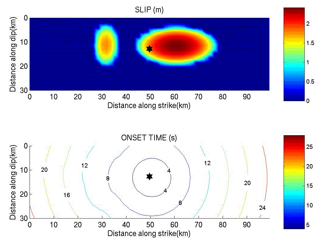
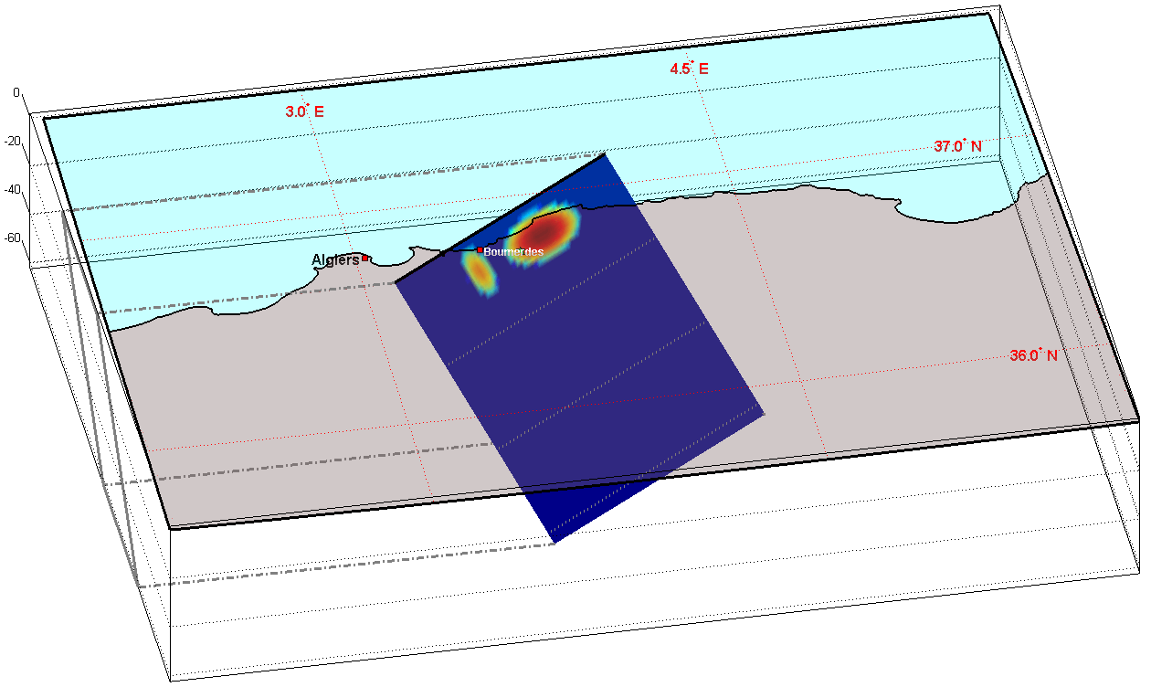
The results, based on the slip patch method reported by Vallée and Bouchon (2004), indicate that the rupture represents a system of uniform slip zones. In the case of the Algiers earthquake, a satisfactory estimate of P-wave signal complexity can be obtained using two patches. We assume fault orientation to be known (mechanism provided by the Harvard laboratory) and a hypocentral depth of 10 km. The epicenter is represented by the star on the slip plane (Figure 1). Source duration is approximately 17 s. Figure 2 represents the rupture plane underneath the Algerian coast in 3D.
Waveform estimate and comparison with recordings
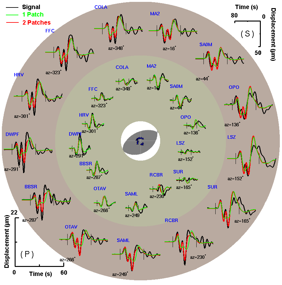
Signal inversion was performed using 13 IRIS Consortium and CEA stations. Inverted signal duration is 28 s for the P phase (signals on the outer disk in Figure 3) and 32 s for the SH phase (signals on the inner disk). Each station azimuth relative to the epicenter is indicated next to each signal. The black signal is the recorded signal, the green one is the estimated signal describing the slip with only one slip patch, and the red signal is the estimated signal describing the slip with two patches.
 |
 |
Figure 3 |
|
This model enabled us to confirm the fault plane geometry provided by the Harvard laboratory. In addition, it gave an indication of how the slip occurred on the fault. The recordings from the seismic sensors matched the digital signals from this simulation relatively well and enabled us to confirm this description of the seismic rupture.
|