 |
 |
|
|
|
Helicopter- and car-borne radioactivity mapping |
|
|
|
|
|
 Radiological diagnosis of the ground Radiological diagnosis of the ground |
|
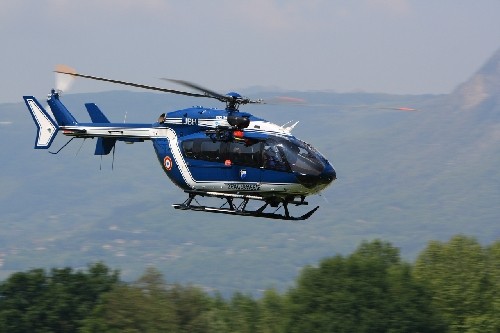
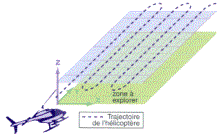
In just a few hours, the Hélinuc® helicopter-borne γ mapping system can produce a radiological diagnosis of an area between tens and hundreds of square kilometers. Hélinuc® has the capability to identify radionuclides with a sensitivity ranging from the natural radioactivity level to that of a severe accident situation. |
|
|
|
|
|
Main missions |
|
|
|
Defense |
|
|
 |
Intervention in the event of an incident or accident, |
|
|
Systematic mapping of nuclear facilities, |
|
|
Taking part in national and international exercises. |
 |
Hélinuc System®:
on-board γ detector in a box under the helicopter. |
|
|
|
Simultaneous acquisition of a γ spectrum and the helicopter's position. |
|
|
|
|
|
Automated intervention in the event of an accident for the "Intra" economic interest group |
|
|
|
Practice interventions and interventions in the event of an incident or accident, |
|
|
Systematic mapping of nuclear sites:
|
| |
|
EDF : nuclear electric power plants, |
| |
|
CEA : research centers, |
| |
|
Orano : nuclear plants. |
|
|
|
|
International |
|
|
|
IAEA
| Radionuclides |
NaI detector |
GeHP detector
(2 second) |
GeHP detector
(60 second) |
| 137Cs (kBq/m²) |
1 |
6,5 |
0,5 |
| 154Eu (kBq/m²) |
2 |
10 |
1 |
| 40K (Bq/kg) |
30 |
620 |
10 |
| 238U (Bq/kg) |
10 |
260 |
20 |
| 232Th (Bq/kg) |
3 |
130 |
13 |
|
|
Detection limits (1σ, 40m altitude) |
|
|
|
|
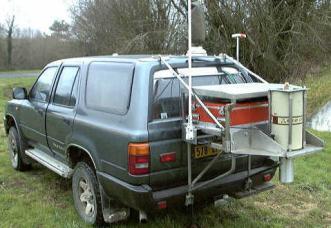
Autonuc |
|
|
|
Like the helicopter-borne γ mapping system, a car-borne system is particularly useful for tracking lost sources, particularly since Autonuc measurements are more sensitive than Hélinuc ones.
|
γ detector located at the rear of the vehicle. |
|
|
|
|
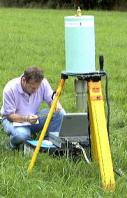
In
situ |
|
|
|
In addition, in situ measurements are also used periodically to confirm activities in a given location.
|
In situ γ measurement at a given point. |
|
| |
|