 |
 |
 |
 |
 |
Pollutant transfer in the geological environment |
 |
 |
 |
An understanding of the mechanisms by which water and pollutants are transferred to ground, rock and ground water is necessary for planning site development and future operations.
This approach involves 3 steps:
 |

 |
Natural system characterization. |
 |

 |
Testing. |
 |

 |
Simulation of the natural system and its development. |
|
 |
|
 |
 1
- Characterization of the natural system 1
- Characterization of the natural system |
 |
|
 |
 |

 |
Geology and hydrogeology of sites.
Data collected in the field and from drill cores provides information about subsoil type and structure, together with water drainage direction and speed. |
 |
|
 |
|
 |
Example of 3D restoration of the geological character of the ground. |
|
|
 |
Observation of quartz grain surface through a scanning electron microscope. |
|
 |

 |
Water and soil geochemistry.
In situ measurements and sampling are used to produce maps and profiles of sites for environmental monitoring purposes. |
 |
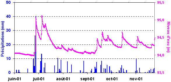
Groundwater replenishment by rainy periods. |
 |
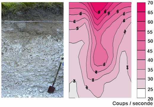
Ground section and its radioactivity distribution map. |
|
 |
|
 |
 2
- Testing to build substantiated models 2
- Testing to build substantiated models |
 |
|
 |
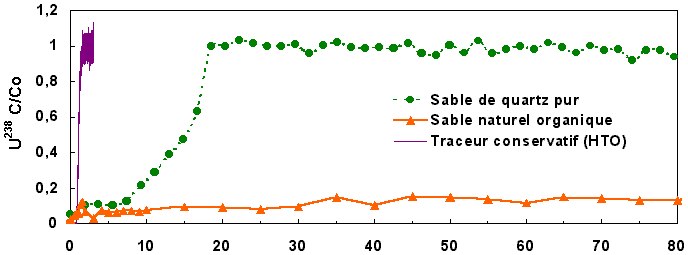
Laboratory characterization of the elemental mechanisms responsible for water drainage and pollutant migration; analog modeling of column migration.
 |
Curves showing sand column infiltration of tritium and uranium (x-axis = pore volume renewal number) |
Natural site instrumentation
 |

 |
Physical and chemical monitoring of soil, rocks, and groundwater. |
 |

 |
Thermo-hydro-mechanical system study. |
 |

 |
Meteorology. |
 |
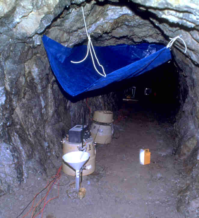
Sequential sampling of infiltration water in an underground gallery. |

 |
Diagram of a multiparameter station for continuous monitoring of interactions between the atmosphere, soil and groundwater. |
|
 |
|
 |
 3
- Simulation of the natural system and its development 3
- Simulation of the natural system and its development |
 |
|
 |
 |

 |
Numerical modeling of hydrogeological transfers:
Simulation of underground water drainage and transport of radionuclides from solid, liquid or gaseous waste in the ground or the atmosphere. |
 |

 |
Numerical modeling of the chemical behavior of radionuclides in the environment:
determination of species in solution, dissolution and desorption reactions, and simulation of fluid-rock interactions. |
 |

 |
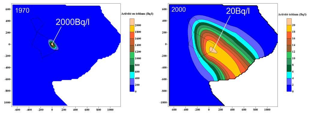
Combined hydrogeological and geochemical modeling
of radionuclide transport into the ground and aquifers. |
 |
Modeling of the 30-year development of tritium concentrations in an aquifer from a theoretical source. |
Modeling of hydrogeological processes provides a 3D-representation of the transfer of surface water into the groundwater.

 |
2D simulation of the surface of groundwater given infiltration from the ground. |
Numerical model coupling can be used to simulate migration of a radionuclide to the natural environment, by integrating the set of processes responsible for transport, such as water drainage, radionuclide speciation and its interactions with ground components.

 |
Simulation of vertical uranium migration to siliceous soil from a point source. |
|
| |
|